Festival Site Map
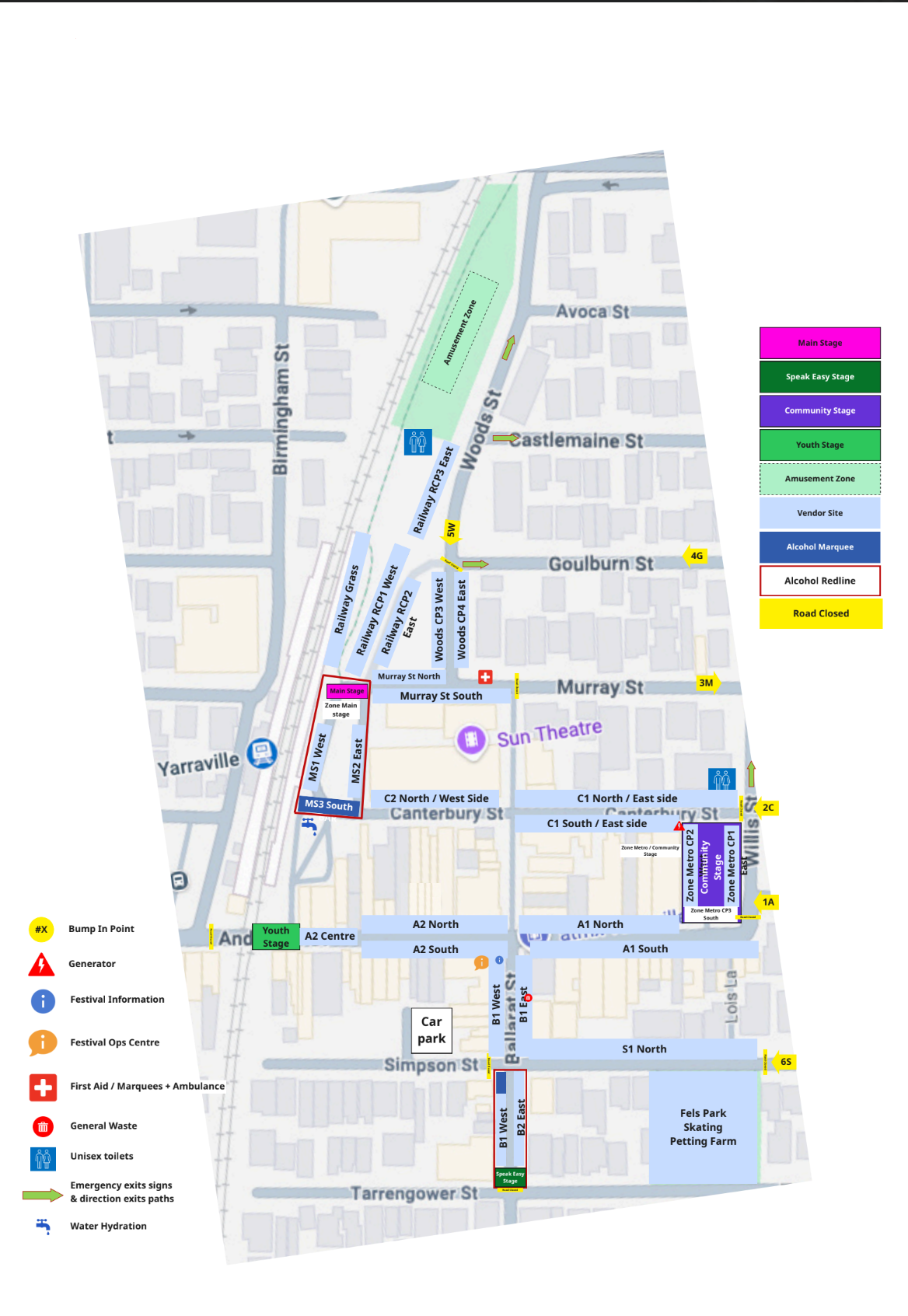
The Yarraville Festival site map provides an overview of key locations, facilities, and designated areas across the festival precinct.
Visitors are encouraged to review the site map to assist with navigation throughout the festival. The map identifies important amenities, activity zones, and safety points to ensure a safe and accessible experience for all attendees.
Key Locations and Facilities
The site map includes clearly marked locations for essential services and facilities, including:
- Public toilet facilities
- Food and beverage areas
- Licensed areas and designated consumption zones
- Entertainment stages and activity zones
- Kids’ Zone and family areas
- Information points
Safety and Emergency Information
The safety of attendees is a priority. The site map identifies:
- Emergency evacuation points
- First aid locations
- Access routes for emergency services
In the event of an emergency, attendees should follow directions from event staff, volunteers, and emergency services personnel.
Accessibility
The site map also highlights accessible pathways and key facilities to support all visitors. Attendees requiring assistance are encouraged to seek help from information points or event staff.